
Most visitors picture a single peak when they hear the name but Bell Rock is actually a sprawling sandstone formation you can circle, climb partway up or scramble to the top of depending on your nerve. The rock earned its bell shape from thousands of years of wind and water cutting into soft Permian-era sandstone. Locals will tell you the formation sits on one of Sedona’s four main energy vortex sites and whether or not you buy into that, the view from halfway up justifies the climb on its own. This guide walks through everything you need before you lace up your boots and head out on the Bell Rock Trail.
In this guide you will find:
– The exact distance and elevation gain along the main path
– How difficult the scramble section really is and where most people turn back
– The three parking lots you can use and how early to arrive in high season
– Which months bring cooler temperatures and clearer skies
– How the loop connects to Courthouse Butte for a longer hike
– What most first-time hikers get wrong about the climb
QUICK INFO
Location: Along Highway 179, between Sedona and the Village of Oak Creek, Arizona
Nearest Airport: Phoenix Sky Harbor International Airport (PHX), about 110 miles (2 hours) south
Best Time to Visit: October through April for cooler hiking weather start early from May through September to avoid extreme heat
Travel Time from Sedona Uptown: About 12 minutes by car (6.5 miles)
Recommended Time: 1.5 to 3 hours, depending on how far you hike and how long you spend exploring the rock formations
Average Daily Cost: $5 for a Red Rock Pass (required for most trailhead parking) or free with a valid America the Beautiful Pass
What Makes Bell Rock Trail Worth Hiking
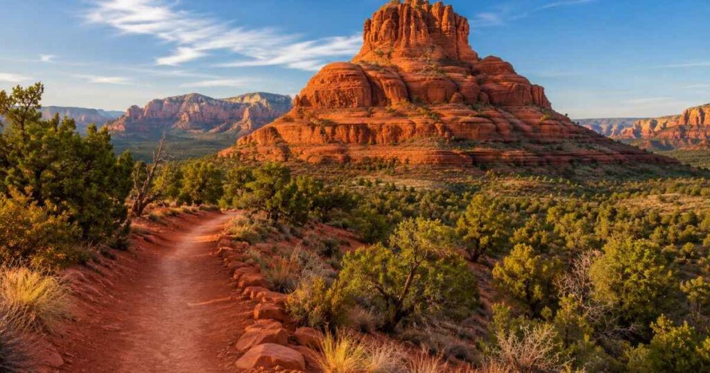
The base loop covers 1.2 miles of mostly flat, well-marked path with red dirt underfoot and juniper trees scattered along the edges. Unlike many Sedona hikes that require technical gear, this route lets you choose your own difficulty level by deciding how far up the rock face you want to go. Casual walkers stick to the packed dirt loop at the bottom, while more adventurous hikers scramble up slickrock ledges that gain roughly 500 feet in elevation. The formation itself rises 4,919 feet above sea level and from the upper ledges you get a clear line of sight to Courthouse Butte, Cathedral Rock and the Village of Oak Creek below.
What separates the Bell Rock Trail from similar red rock climbs nearby is the sandstone traction. The rock stays grippy even when it looks smooth, which is why so many hikers feel comfortable pushing higher than they originally planned. That said, the higher ledges narrow quickly and a few sections require hand holds on exposed rock with a real drop on one side.
Pro Tip: Wear shoes with sticky rubber soles rather than standard running shoes, since smooth tread slips on the sandstone once dust builds up in dry months.
Bell Rock Trail Difficulty and Distance
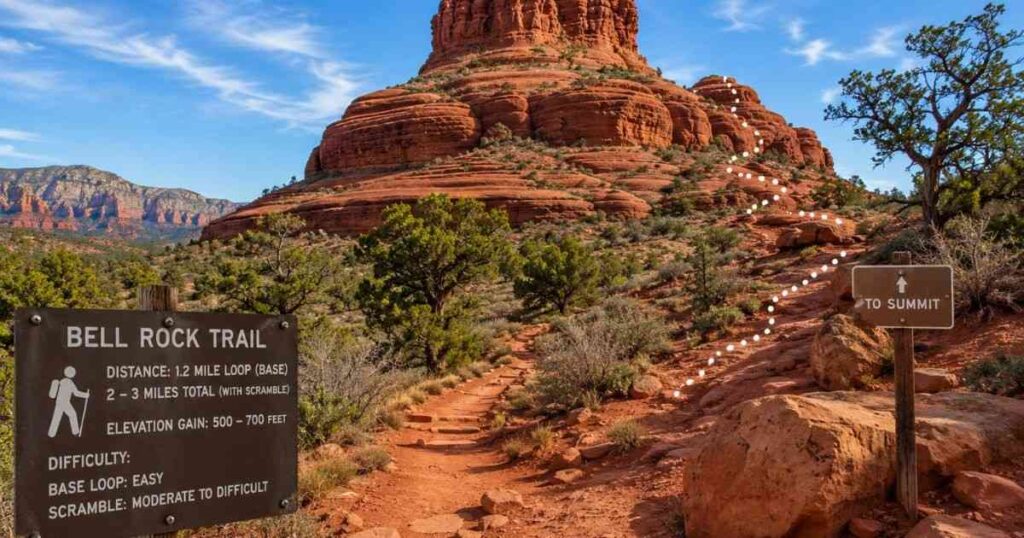
The full loop trail measures 1.2 miles if you stay on the marked path circling the base but most hikers add distance by climbing the informal scramble routes that branch off partway around. Add those detours and you’re looking at 2 to 3 miles total with 500 to 700 feet of elevation gain, depending on how high you go.
Rangers classify the base loop of the Bell Rock Trail as easy, while the scramble sections earn a moderate to difficult rating because of exposed rock and loose gravel near the top third. Trail markers thin out considerably above the first ledge, so hikers rely on cairns and worn rock patches rather than official signage once they start climbing.
Many hikers connect this route to the Courthouse Butte Loop for a combined 4-mile hike that circles both formations and returns to the same parking area. That extension stays flat and adds minimal difficulty, making it a good option if you want mileage without more climbing. Families with young kids typically stop at the first flat ledge, about 15 minutes up, which already offers a strong view without any real risk.
Verdict: Treat the base loop as an easy 45-minute walk and treat any climbing above the first ledge as a separate, more serious activity requiring proper footwear and caution.
Best Time to Hike Bell Rock Trail
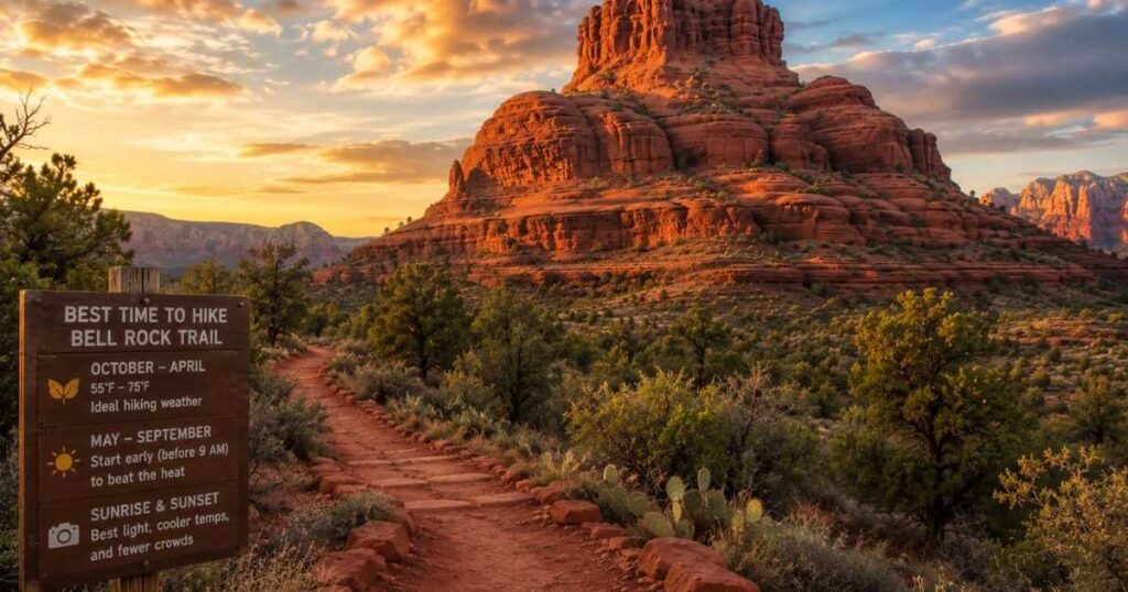
October through April brings daytime temperatures between 55 and 75 degrees Fahrenheit, which makes climbing the exposed rock sections far more comfortable than summer attempts. Sedona’s elevation near 4,500 feet keeps mornings cool even in warmer months but by June through August, afternoon temperatures regularly climb past 100 degrees on the exposed sandstone with zero shade. Hiking before 9 a.m. during summer avoids both the heat and the crowds that build up by mid-morning.
Winter mornings occasionally bring frost on the upper ledges, which makes the normally grippy sandstone dangerously slick for an hour or two after sunrise. Sunset hour, roughly 30 to 45 minutes before dark, turns the rock a deep orange-red that draws photographers to the same ledges hikers use during the day. Spring and fall weekends see the Bell Rock Trail parking lots fill by 9 a.m. so arriving right at sunrise gives you both cooler air and open parking spots. Humidity stays low year-round in this part of Arizona, which means the heat feels more intense on skin than the thermometer number alone suggests.
Pro Tip: Check the sunrise time for your visit dates and arrive 20 minutes before it, since the lower morning light on the red rock face is the best window for photos and the coolest window for climbing.
Getting to Bell Rock Trail and Parking
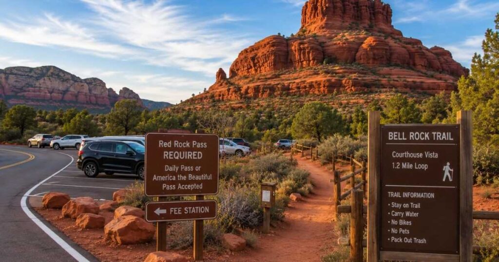
Three parking areas serve hikers along Highway 179: the main Bell Rock Vista lot directly across from the formation, the Courthouse Vista lot half a mile south and a smaller pullout used mostly in overflow situations. All three require a Red Rock Pass, sold at self-pay stations on site for 5 dollars a day or 15 dollars for a weekly pass if you’re hiking multiple trails during your stay. The America the Beautiful annual pass covers parking here as well, so frequent national park visitors can skip the daily fee entirely.
From Sedona’s Uptown district, the drive down Highway 179 takes about 12 minutes and from the Village of Oak Creek it’s closer to 5 minutes heading north. Rideshare service through Uber and Lyft operates in the area but wait times run long during peak season, so driving your own vehicle or renting one in Sedona remains the more reliable option. The Bell Rock Trail trailhead sits directly off the parking lot, with clear signage marking the base loop and the informal scramble paths. A vault toilet sits near the main lot but there’s no water fountain on site, so fill up before you leave your hotel or rental.
Pro Tip: Arrive by 8 a.m. on weekends between March and May, since the main lot regularly reaches capacity by mid-morning during peak wildflower season.
What Most Hikers Get Wrong
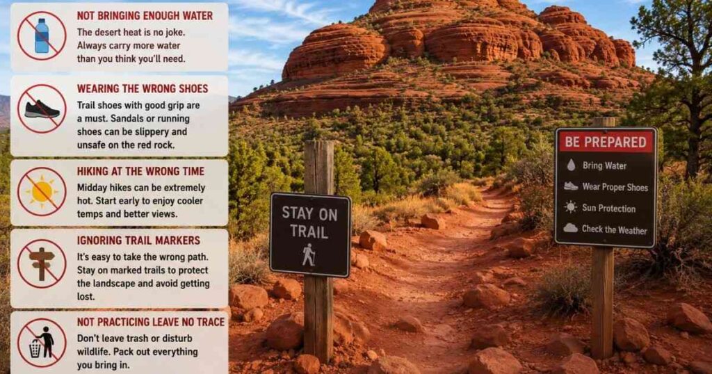
First-time visitors often assume the Bell Rock Trail is a single continuous path to the summit but the formation has no marked route all the way to the top and the actual summit requires technical climbing skills most day hikers don’t have. The sections tourists photograph from below look more vertical than they feel once you’re standing on them, which leads some hikers to climb higher than their comfort level allows before realizing they need to come back down the same exposed section.
Turning around at any point is normal here and locals recommend stopping well before any ledge that requires a committed jump or a stretch you can’t easily reverse. Another common mistake involves timing the visit around midday in warmer months, when the sandstone radiates stored heat with no shade cover anywhere on the formation.
Bringing at least one liter of water per hour of planned hiking time matters more here than on shaded forest trails, since dehydration sets in faster on exposed rock. A few hikers also skip checking the Courthouse Butte connector trail, missing an easy way to extend the Bell Rock Trail without adding real difficulty. Cell service drops out in patches along the base loop, so downloading an offline map before you arrive saves you from relying on a signal that may not show up when you need directions back to the lot.
Verdict: Respect the informal nature of the upper routes, turn back before any section feels irreversible and carry more water than you think you’ll need.
You may also like:
Frequently Asked Questions
How many days do you need for Bell Rock Trail?
You only need one visit to the Bell Rock Trail, lasting 1.5 to 3 hours, to experience the full loop and a partial climb up the rock face. Most visitors pair this hike with Cathedral Rock or Courthouse Butte on the same day, since all three trailheads sit within a 10-minute drive of each other. A single morning covers the highlights without feeling rushed.
Is Bell Rock Trail worth hiking?
Yes, it consistently ranks among Sedona’s most photographed formations because the climb rewards effort with panoramic views in every direction. The base loop alone justifies the drive even without climbing, since the red rock scenery holds up on its own at ground level. Few hikes in the area offer this much visual payoff for such a short time commitment.
What is the best time of year to hike Bell Rock Trail?
October through April offers the most comfortable hiking temperatures, typically between 55 and 75 degrees Fahrenheit during the day. Summer hikes are possible but only advisable before 9 a.m. due to extreme heat on the exposed sandstone. Winter mornings can bring brief icy patches on the upper ledges, so a slightly later start avoids the worst of the frost.
Is Bell Rock Trail expensive to visit?
No, parking costs only 5 dollars per day through the Red Rock Pass system or nothing at all with an America the Beautiful annual pass. There’s no separate entry fee for the trail itself, unlike some nearby attractions in Sedona that charge for guided access. A day trip here can realistically cost under 10 dollars in parking fees alone.
Can you combine Bell Rock Trail with Courthouse Butte?
Yes, the two connect through a shared loop trail that adds roughly 2.8 miles to the base Bell Rock distance. This combined route stays mostly flat, making the Bell Rock Trail a low-difficulty way to see two major formations in one outing. Hikers looking for more mileage without more climbing use this connector regularly.
Final Thoughts
The Bell Rock Trail earns its reputation because it offers three different hikes in one: an easy loop for casual walkers, a moderate scramble for those wanting a view from higher up and an extended route toward Courthouse Butte for anyone chasing more distance. The short drive from both Sedona and the Village of Oak Creek makes the Bell Rock Trail one of the easiest red rock hikes to fit into a single morning, regardless of how much time you have that day.
Pack more water than feels necessary, check the forecast the night before and give yourself the full window between sunrise and mid-morning if climbing above the first ledge is part of your plan. Start at the lower ledge, decide how far your comfort level takes you and remember that the best view often sits just one flat rock short of where most people stop climbing.

