
Most people picture a straight shot down the coast when they imagine a Pacific Coast Highway road trip but the real drive is anything but direct. The road twists through cliffside curves, drops into fog banks near Mendocino and climbs above 1,000 feet along the Big Sur coastline before dropping back to sea level minutes later.
This guide breaks down exactly how to plan a pacific coast highway road trip that fits your schedule, budget and sense of adventure, whether you have three days or two weeks. Planning ahead matters here more than on a typical highway drive, since a poorly timed pacific coast highway road trip can mean sitting in thick fog for hours instead of taking in the coastline you came to see.
IN THIS GUIDE YOU WILL FIND:
- The exact route breakdown from San Francisco to Los Angeles, mile by mile
- Where to stop for the best views, food and photo opportunities
- Realistic daily costs for gas, lodging and meals along the way
- The safest driving strategy for Big Sur’s narrow, cliffside sections
- Seasonal timing advice so you avoid fog, crowds and road closures
- Common mistakes first-time drivers make on this route
Quick Info Box
Starting Point: San Francisco or Los Angeles (driveable in either direction)
Total Distance: Approximately 655 miles (1,055 km) one way
Recommended Days: 5–7 days for a relaxed road trip (3 days minimum)
Best Time to Drive: April–May or September–October for pleasant weather, clearer skies and lighter crowds
Average Daily Cost: $150–$250 per person, including lodging, meals and fuel
Nearest Major Airports: San Francisco International Airport (SFO) and Los Angeles International Airport (LAX)
PLANNING YOUR PACIFIC COAST HIGHWAY ROAD TRIP ROUTE
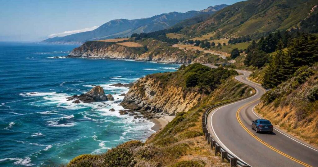
A pacific coast highway road trip typically runs along Highway 1, connecting San Francisco to Los Angeles across roughly 655 miles. Most travelers drive south to north or north to south but driving southbound puts you in the outside lane closest to the ocean views, which matters on the narrower Big Sur stretches. The full drive takes about 13 hours of pure driving time without stops, so spreading it across 5 to 7 days lets you actually enjoy the coastline instead of racing through it.
Key towns to anchor your route include Half Moon Bay, Monterey, Carmel-by-the-Sea, Big Sur, San Luis Obispo and Santa Barbara. Each sits roughly 1.5 to 3 hours apart by car, making them natural overnight stops. Renting a car in San Francisco and dropping it off in Los Angeles (or vice versa) usually costs $50–$100 more than a round-trip rental but it saves you from backtracking the entire route.
Fuel costs along this pacific coast highway road trip run higher than inland California because gas stations in remote stretches like Big Sur charge a premium, often $1–$1.50 more per gallon than cities. Budget around $150–$200 total for gas on a one-way trip in a standard sedan. Cell service also drops out for long stretches south of Carmel, so download offline maps before you start driving.
Many travelers ask whether an SUV is necessary for a pacific coast highway road trip but a standard sedan handles the route fine since the road is fully paved and maintained. The main advantage of a larger vehicle is trunk space for beach gear and camping equipment if you’re stopping at state parks along the way. Parking in Carmel-by-the-Sea and Santa Barbara can be tight during peak season, so a smaller car actually makes finding a spot easier in those two towns specifically.
Pro Tip: Fill your gas tank every time it drops below half, since stations along Big Sur can be 40+ miles apart with no cell service to find the next one.
BEST STOPS AND VIEWS ALONG THE ROUTE
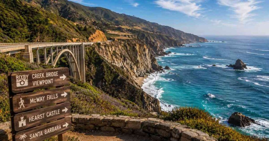
The most photographed section of any pacific coast highway road trip is Bixby Creek Bridge, about 13 miles south of Carmel. The bridge spans 714 feet and sits 260 feet above the water and pulling into the small viewpoint lot early morning (before 8 AM) avoids the tour bus crowds that arrive by mid-morning. McWay Falls, another 25 miles south, drops 80 feet directly onto a private beach and requires only a short half-mile walk from the parking area.
Monterey’s 17-Mile Drive costs $11.25 per vehicle and winds past the Lone Cypress tree and several exclusive golf courses, including Pebble Beach. Most visitors don’t realize you can skip this fee entirely by having lunch at one of the restaurants inside the gated area, which typically waives the entrance charge. Further south, Hearst Castle near San Simeon offers guided tours starting at $30 per adult and the Grand Rooms Tour takes about 1 hour and 45 minutes.
Santa Barbara marks a natural transition point where the coastline shifts from dramatic cliffs to palm-lined beaches. The Santa Barbara Courthouse offers free rooftop views of the city and ocean and State Street’s restaurants average $20–$35 per entree for dinner. Compared to Big Sur, where dining options are limited and pricier due to remote sourcing, Santa Barbara gives you more variety at lower cost.
Pro Tip: Book Hearst Castle tickets online at least 48 hours ahead, since walk-up tours sell out completely during summer weekends.
BEST TIME OF YEAR AND DAY TRIP OPTIONS
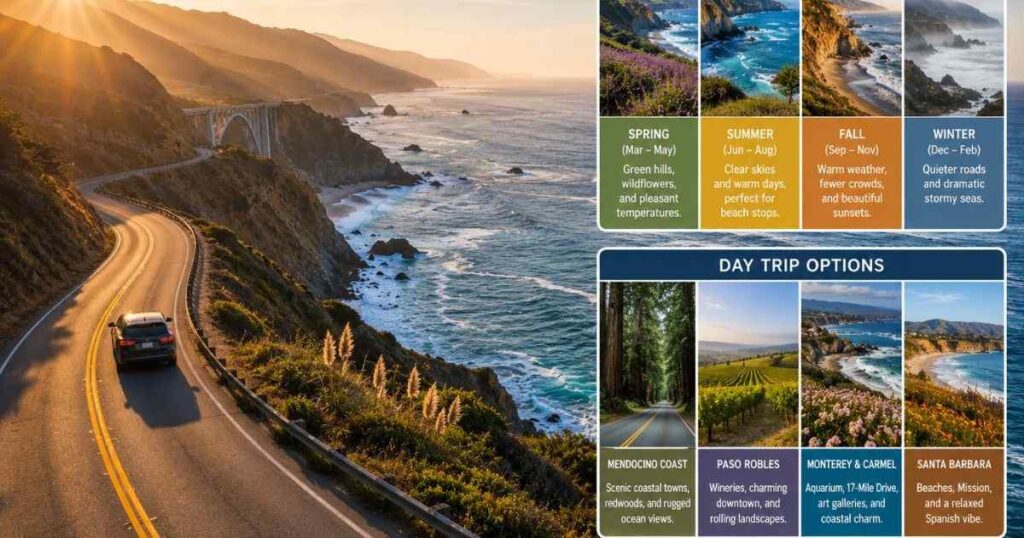
Timing your pacific coast highway road trip around the weather changes the entire experience. Coastal fog rolls in heavily between June and August, sometimes not burning off until 1 or 2 PM, which can hide the views you’re driving hours to see. April, May, September and October offer the clearest skies with daytime temperatures between 65–75°F and significantly fewer tourists at major stops.
Winter months (December through February) bring the added benefit of gray whale migration, visible from bluffs near Monterey and Big Sur between late December and April. Storm watching also becomes popular in Cambria and San Simeon during January, when waves can reach 15–20 feet. Rain does occasionally close sections of Highway 1 near Big Sur due to landslides, so check Caltrans road conditions before departing.
If you don’t have time for the full route, a day trip from San Francisco to Half Moon Bay and back covers 60 miles round trip and takes about 2.5 hours including stops. A day trip from Los Angeles to Santa Barbara covers 95 miles each way and fits comfortably into a single day with time for lunch and beach walking.
Both options let you experience a shorter version of a pacific coast highway road trip without committing to the full multi-day drive. Either day trip works well as a test run before booking a longer pacific coast highway road trip later in the year.
Verdict: Spring and fall consistently deliver the best combination of clear weather, manageable crowds and full road access along the entire route.
PRACTICAL TIPS FOR DRIVING AND WHAT TO AVOID
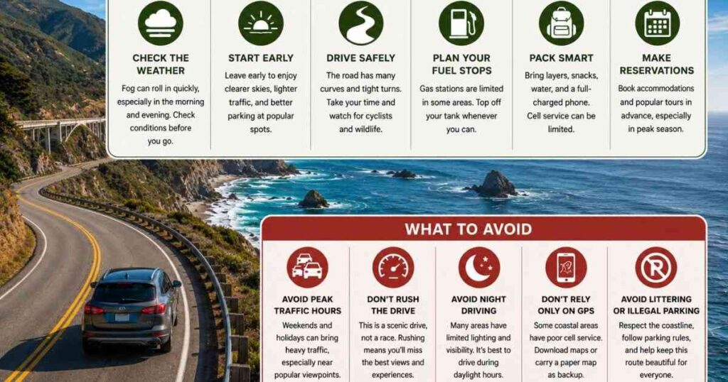
Driving Big Sur’s narrower sections requires patience more than skill. Speed limits drop to 25–35 mph on curves and pulling into designated turnouts to let faster local traffic pass keeps things moving safely for everyone. Renting a car with good brakes and testing them on a straightaway before hitting steep grades matters more here than horsepower or fuel economy.
Avoid attempting this drive after dark, especially between Ragged Point and San Simeon, where guardrails are minimal and wildlife crossings happen frequently. Most first-time drivers on a pacific coast highway road trip also underestimate how long stops take a “quick photo” at Bixby Bridge easily turns into 30 minutes once you factor in parking and walking to the viewpoint. Building in this extra time from the start keeps your pacific coast highway road trip on schedule without feeling rushed at each stop.
Book accommodations in Big Sur at least 2–3 months ahead for summer travel, since the area has fewer than 500 hotel rooms total across the entire stretch. Cambria and San Luis Obispo offer more availability and lower rates, averaging $150–$220 per night compared to $300+ in Big Sur proper. Packing layers matters too, since coastal temperatures can swing 20 degrees between morning fog and afternoon sun.
Another detail most guides skip at gas stations along a pacific coast highway road trip rarely accept cash only but a few remote pumps near Gorda still run on outdated card readers that decline foreign cards. Carrying at least $60–$80 in cash covers you in these spots without forcing a long detour. Checking your spare tire and roadside assistance coverage before leaving also saves hours, since tow trucks in Big Sur can take over an hour to reach a breakdown location.
Pro Tip: Download the Caltrans Quick Map app before you leave cell coverage, since it shows real-time road closures without needing an active signal once cached.
You may also like:
Swim with Leopard Sharks La Jolla
Harbor House Inn Elk California
Frequently Asked Questions
How many days do you need for a Pacific Coast Highway road trip?
Most travelers need 5 to 7 days to comfortably drive the full 655-mile route between San Francisco and Los Angeles. Three days works if you only want to cover the highlights, like Big Sur and Monterey but you’ll skip southern stops like Santa Barbara. Adding extra days lets you build in hiking, whale watching or beach time without rushing between towns. A well-paced pacific coast highway road trip also leaves room for spontaneous stops that don’t show up on any itinerary.
Is a Pacific Coast Highway road trip worth doing?
Yes, the combination of coastal cliffs, redwood forests and small beach towns makes this one of the most varied drives in the country. Unlike highway drives that stay flat and repetitive, this route changes character every 30–40 minutes. The scenery alone justifies the extra driving time compared to taking Highway 101 inland.
What is the best time of year to drive the Pacific Coast Highway?
April, May, September and October offer the clearest skies and mildest temperatures, typically between 65–75°F. Summer months bring heavy morning fog that can linger until early afternoon, blocking coastal views. Winter offers whale watching but comes with a higher chance of rain-related road closures near Big Sur.
Is a Pacific Coast Highway road trip expensive?
Budget $150–$250 per person per day covering gas, meals and lodging, though Big Sur specifically runs higher due to limited hotel supply. A 5-day trip for two people typically costs $1,500–$2,000 total including a mid-range rental car. Staying in nearby towns like Cambria or San Luis Obispo instead of Big Sur itself cuts lodging costs by 30–40%.
Can you do a shorter version of the Pacific Coast Highway road trip as a day trip?
Yes, driving from San Francisco to Half Moon Bay and back covers about 60 miles and takes roughly 2.5 hours with stops. From Los Angeles, a day trip to Santa Barbara covers 95 miles each way and leaves time for lunch and a beach walk. Neither option replaces the full multi-day drive but both give you a taste of the coastline in a single afternoon.
FINAL THOUGHTS
A pacific coast highway road trip rewards travelers who slow down rather than those trying to check off every stop. The route’s real value lies in the small moments, like pulling over unplanned when fog lifts over Bixby Bridge or catching a whale spout from a bluff near Big Sur. Give yourself at least five days, fill your gas tank before entering remote stretches and book Big Sur lodging months in advance if you’re traveling in summer. When you reach McWay Falls, skip the main overlook crowd and walk 200 feet further down the trail to the quieter viewpoint on the left, where you’ll get the same waterfall view with a fraction of the people.

